
Albany ZIP Code Coverage Starts With 94706
Research identifies 94706 as Albany's primary postal ZIP. USPS routing also places 94707 and 94710 in the regional picture near the Berkeley edge. Those numbers should be treated as delivery geography until a complete address is checked. A ZIP may reach beyond the incorporated city, and a city parcel may carry a neighboring postal label.
| Postal area | Areas covered in the research | Post office or geography | Notes |
|---|---|---|---|
| 94706 | Primary Albany mailing area | Albany Post Office, 1191 Solano Avenue | Best default for an Albany mailing address; verify the exact street |
| 94707 | Berkeley and Kensington-oriented regional routing touching the Albany edge | Berkeley postal geography | Do not label every 94707 address Albany |
| 94710 | West Berkeley industrial or waterfront-oriented regional routing beside Albany | Berkeley postal geography | Possible border or business routing; confirm the parcel |
The table is a routing guide, not a claim that each ZIP is wholly inside Albany. USPS determines delivery form. Alameda County GIS determines incorporated jurisdiction. The assessor and recorder use parcel and legal-description identifiers.
USPS Fields for an Albany Postal Search
The USPS lookup tool has three useful modes. Find by Address accepts a street and optional apartment or suite, plus city and state. Find by City and State returns postal areas associated with the city name. Cities by ZIP works in the other direction. Use the first mode when the goal is to verify a real Albany address.
| Find by Address | Street address, apartment or suite when needed, city, and state; returns a standardized address and ZIP+4. |
|---|---|
| Find by City and State | City and state; returns postal areas associated with the entered place name. |
| Cities by ZIP | ZIP; returns preferred or acceptable city names tied to postal routing. |
| Find and Clear | Validation and reset controls; save the standardized result with the access date. |
The USPS postal lookup capture below is linked to the live federal postal tool.
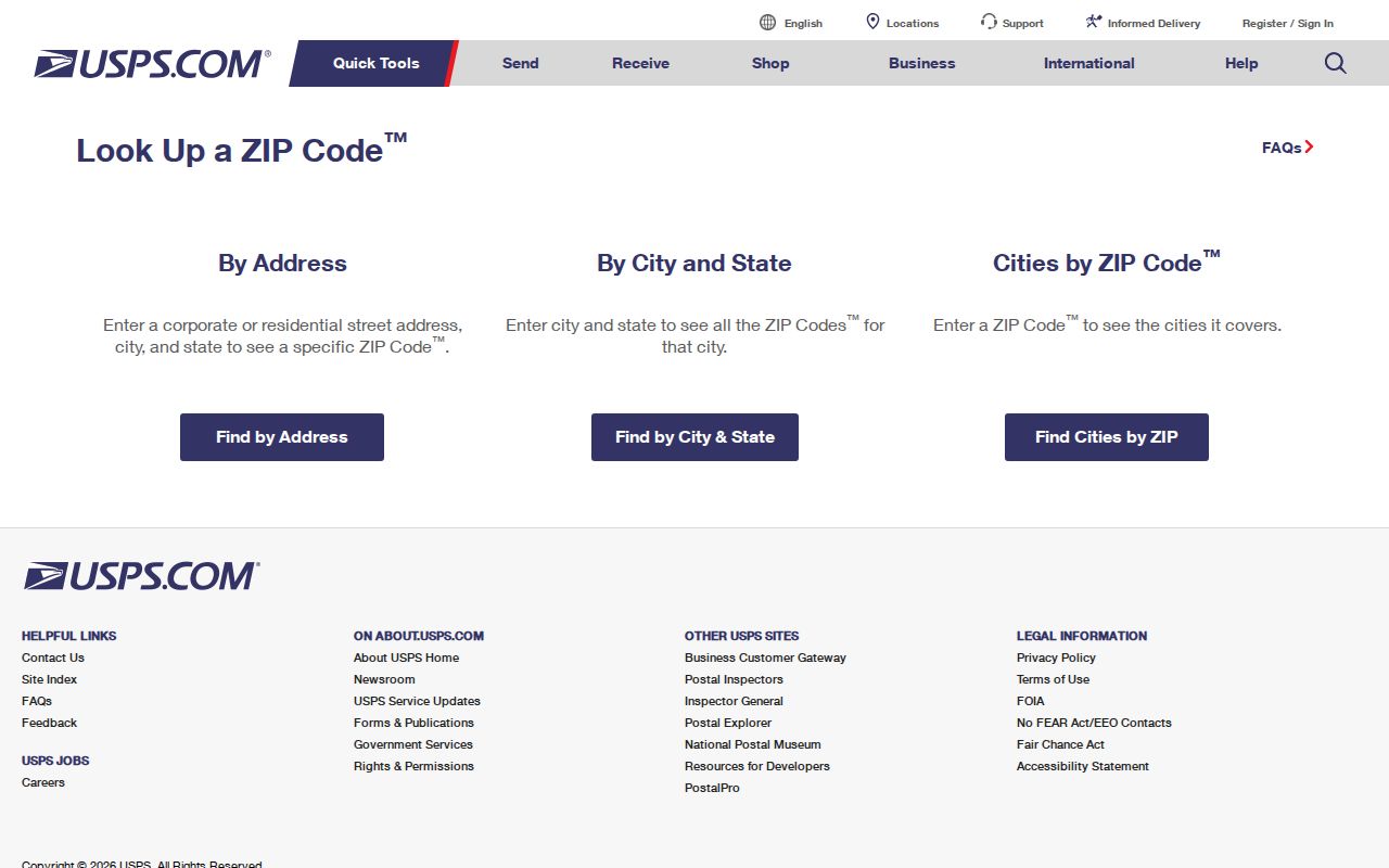
That screen is the postal check to run before an address moves into Alameda County property or tax systems.
ZIP+4 adds delivery precision. It does not turn a postal route into a parcel boundary or prove who receives mail there.
The Albany Post Office on Solano Avenue
The official Albany Post Office listing identifies 1191 Solano Avenue, Albany, California 94706-1682. The location is a useful postal anchor for an Albany ZIP code directory, but it is not a city resident registry. The post office can help confirm delivery geography and the preferred mailing label. It cannot certify a parcel's title or identify every person who receives mail at an address.
The USPS listing for the Albany Post Office is the source for that location and ZIP. Use it with the address lookup, not as a substitute for a complete address check.
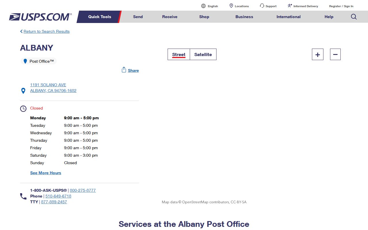
The post-office image supplies a concrete postal reference while the county parcel tools answer the land and jurisdiction questions.
Postal city labels can also reflect regional routing. If a record says Berkeley, compare the street, ZIP, GIS city, and legal description before treating it as an Albany mismatch.
Find Albany Residents by ZIP Code
A ZIP-first resident search is a narrowing workflow. Few public records are built as ZIP-wide people lists. Property and tax tools accept a complete address or APN. DCA and unclaimed-property systems may use city or ZIP as a secondary filter. Business filings are entity-centered. Courts search parties and cases. Voter files have statutory access gates.
- Run the complete street and unit through USPS, then save the standardized address and ZIP+4.
- Use the Alameda County Property Assessment Information search or tax search to convert the address into an APN and parcel record.
- Check the Parcel Viewer for the incorporated city, parcel shape, adjacent lots, and map layers.
- Choose a name, court, license, business, unclaimed-property, directory, or deed source based on the fact being tested.
- Once a ZIP narrows to a street, use the Albany street directory for the address-keyed chain rather than treating the ZIP as the final answer.
A result should state the ZIP, the search mode, the source date, and the record's scope. That makes it possible to tell a postal clue from a property fact or historical household entry.
What 94707 and 94710 Mean at Albany's Edge
The 94707 and 94710 references are the geography wrinkle in an Albany ZIP code directory. The research describes 94707 as Berkeley or Kensington-oriented routing touching the Albany and north Berkeley edge, and 94710 as west Berkeley industrial or waterfront-oriented routing adjacent to Albany. Neither number should be used as a city label without address-level verification.
Albany's compact form makes parcel review practical. Check the USPS preferred city, the county's incorporated-city layer, and the assessor situs. A business or waterfront address may have a postal relationship that does not match the city a reader expects from the ZIP alone.
Geographic clues can be useful without becoming a claim about a household. A ZIP narrows the area. GIS resolves the parcel. The deed's legal description preserves continuity when postal language changes.
Keep the denominators apart. Census postal tabulation areas approximate delivery geography and are not the same as the City of Albany. Use Census place facts for city statistics, USPS for delivery, and GIS for jurisdiction.
From ZIP Code to Address to APN
The reliable bridge is short: ZIP to standardized address, address to APN, APN to parcel map, APN to assessment and tax facts, then APN and legal description to the recorder index. The county property hub links those modern tools. A deed is still the transfer evidence, and the recorder is not reliably searchable by ZIP.
Do not begin a historical title chain with a postal label. Search PropInfo or the tax tool, record the APN and assessor map, then use the latest vesting deed. If the APN has changed after a subdivision, lot-line adjustment, condominium creation, or combination, bridge the change with recorded maps and legal descriptions.
- ZIP
- A USPS delivery area used to sort and standardize mail.
- APN
- The assessor's parcel number used to link a mapped land unit to assessment records.
- Situs address
- The physical address assigned to the parcel by a local record system.
- Legal description
- The lot, block, tract, map, or boundary language in a recorded document.
This sequence is why a postal directory is most useful as a first filter. It hands the final identity question to the record custodian with the right key.
Which Albany Portals Accept ZIP Filters
ZIP behavior differs across the official tools. A portal may accept a ZIP only as a narrowing field, display one in a result, or ignore it altogether. The distinction prevents a failed ZIP query from being mistaken for a missing person or parcel.
| Resource | ZIP behavior | Albany use |
|---|---|---|
| USPS | Address, city/state, and ZIP crosswalk modes | Standardize delivery form and ZIP+4 |
| DCA license search | City filter may be available; board interface varies | Narrow a known licensee name to Albany or nearby cities |
| California unclaimed property | City or ZIP can narrow an owner-name result | Check for a holder-reported old Albany connection |
| bizfile Online | Filings display addresses; the main search is entity-focused | Verify an address after identifying the entity |
| Assessor and tax tools | Address or APN rather than general ZIP browsing | Convert one ZIP address to a parcel |
| Recorder and court portals | Party, document, case, and date fields | ZIP cannot replace a name, instrument, or case key |
When a ZIP filter is accepted, record whether it returned a location, an address fragment, or a person-related result. Those outputs have different weight and should not be merged into a single resident claim.
Postal Areas and Albany City Limits
USPS boundaries and Albany city limits answer different questions. A postal route can cross a municipal line, and a parcel inside Albany can carry a label associated with Berkeley service geography. The research did not locate a PO-box-only or unique institutional ZIP that should be assigned to Albany. Do not invent one from a postal search result.
- ZIP versus ZIP+4
- The five-digit ZIP names a delivery area; ZIP+4 narrows the delivery segment but not the land title.
- PO-box ZIP
- A postal ZIP used for box delivery rather than a normal street delivery area; no Albany-specific PO-box-only ZIP was documented here.
- Unique ZIP
- A ZIP assigned to one institution or large delivery point; no Albany-specific unique ZIP was documented in the research.
- Carrier route
- A delivery route within postal geography, useful for mail operations but not a parcel or household boundary.
For a final jurisdiction check, compare USPS, GIS, and the assessor situs. For a historical check, add the deed's legal description and the directory's locality preface. If a ZIP search narrows the question to a street, the street directory owns the next step.
GIS Resolves the Berkeley Border
Albany's border geography is the reason an address-level ZIP check needs a parcel layer. San Pablo Avenue and Solano Avenue are major address corridors, Albany Hill marks a distinct residential area, and waterfront or industrial land west of Interstate 80 can sit in a postal context that is not obvious from a search snippet. Those local anchors are useful only when tied to a mapped parcel.
Open the Alameda County property information hub and the county parcel maps, confirm the parcel polygon and APN, and compare the situs city with the USPS label. If a planning or permit question remains, check Albany's Planning and Zoning office. Then use the legal description for title continuity and a directory preface for historical place coverage. That three-part check keeps an Albany ZIP code directory from flattening a border into a guess.
ZIP research is finished when the postal question is answered and the next custodian is clear. For street-level parcel and deed work, continue with the address method in the Albany street directory.